GIS在区域空间生态环境评价单元划分中的应用

打开文本图片集
中图分类号:X826 文献标识码:A 文章编号:1008-9500(2025)12-0045-03
DOI: 10.3969/j.issn.1008-9500.2025.12.014
Abstract: Geographic InformationSystem(GIS)technologyprovides eficientsupportforthedivisionofregionalecological environment assessment units through multi-sourcedata fusion and spatial analysis.In response to challnges such as difficult data integration,spatial planning conflicts,and imbalances between ecological protection and economic development,basedontheGISplatform,aclassificationsystem forecological protection,agriculturalproduction,urban construction,and transitiozones isconstructedusingthedominantfactormethod,overlayanalysis,andconflictcorction techniques.Research has shown thatthis method notonlysignificantlyreduces spatial conflict rates,butalsoachieves coordinatedoptimzationofcological,agricultural,andurbanfunctions,providingasientificbasisforegionalsustainable development.
Keywords: Geographic Information System (GIS); ecological protection; evaluation unit; space optimization
1GIS技术在深汕智造城空间优化中的实践研究
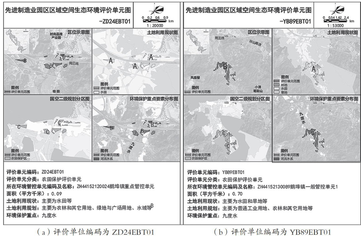
随着城市化进程的加快,区域生态保护与经济发展的空间矛盾日益加剧。(剩余3474字)
