基于GIS的聂拉木县地震滑坡的研究

打开文本图片集
作者简介 郝树峰(1998—),男,山西晋城人,主要从事地质工程研究。
收稿日期 2023-07-30
Research on Earthquake Landslides in Nielamu County Based on GIS
Hao Shu-feng et al(School of Engineering, Xizang University, Lhasa, Xizang 850011)
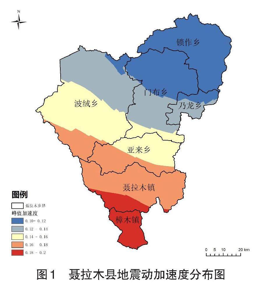
Abstract In this paper, nyalam county was taken as the research object, and the earthquake landslide in the research area was analyzed by analytic hierarchy process based on ArcGIS software, and six influencing factors, such as earthquake peak acceleration, rainfall, slope, aspect, relative height difference and vegetation coverage rate, were selected. By calculating the weight coefficient of each influence factor, the zoning map of predicted earthquake landslide in Nyalam County is drawn and interpreted, which revealed the distribution characteristics of earthquake landslide in Nyalam County, and provided a scientific basis for the relevant departments of disaster prevention and control in Nyalam County to improve their response ability.
Key words GIS; Earthquake landslide; Analytic hierarchy process
摘要 以聂拉木县为研究对象,基于ArcGIS软件运用层次分析法对聂拉木县地震滑坡进行分析并选择地震峰值加速度、降雨量、坡度、坡向、相对高差、植被覆盖率6类影响因子,通过计算各影响因子的权重系数,绘制出聂拉木县预测地震滑坡区划图并进行解译,揭示了聂拉木县地震滑坡的分布特征,为聂拉木县灾害防治相关部门提高应对能力提供科学依据。(剩余3238字)
