基于深度学习的盐碱地遥感影像反演模型构建

打开文本图片集
关键词:深度学习;盐碱地;遥感影像;反演模型;注意力机制中图分类号:TP753 文献标识码:A文章编号:0439-8114(2025)06-0185-05DOI:10.14088/j.cnki.issn0439-8114.2025.06.031开放科学(资源服务)标识码(OSID):
Construction of a remote sensing image inversion model for saline-alkali land based on deep learning
BANRuo-nan,DONGLuan
(CollgeofComputerand Information Engineering,Xinjiang Agricultural University,Urumqi 83oo52,China
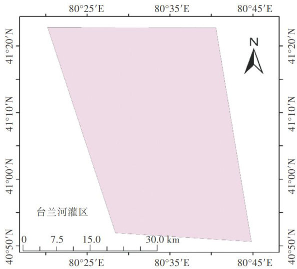
Abstract:Toaddresstheinversionprobemofremotesensingimagesofsaline-alkalilandintheTailanRiverIrgationDistrictof Wensu CuntyAksurefecture,Xinjiang,animageclasificationmodelbasedontheointRendnetworkintegratedwiththeCAttentionmechanismwas proposed.The modelusedDeepLabV3asthebackbone networkandincorporatedtheCoTAtentionmodule to enhancethefeatureextractioncapabityoftenetwork.Toverifytheclasificationperformanceoftheimprovedntwork,experiments wereconductedusing Sentinel-2remotesensing imagesfromtheTailanRiverIrigationDistrict.TheresultsshowedthatthePointRend model achieved good performance metrics,with pixel accuracy,mean intersection over union (MIoU),and FI reaching 89 % , 88% ,and 88% ,respectively.Compared withthe original PointRend model without the CoTAtention mechanism,the improved PointRend model demonstrated enhanced metrics,with pixel accuracy, MIoU ,and FI increasing by 3, 2 ,and 3 percentage points,respectively.TheimprovedPointRendmodelsignficantlyenhancedtheabiltytocapturefinedetailsandrefineedgesinsegmentation tasks,thereby improving overall classification accuracy.
Key Words:deep learning;saline-alkaliland;remote sensing images;inversion model;attention mechanism
盐碱地是中国重要的后备耕地资源。(剩余7522字)
