基于斜坡单元与信息量模型的山区镇域不同降雨情境地质灾害危险性评价

打开文本图片集
中图分类号:P694 文献标志码:A 文章编号:2095-1329(2025)03-0108-0:
Geological hazard risk assessment of a mountainous town under different rainfall conditions based on slope units and information quantity model
LIN Yongna,HE Hongwei* (Qingyuan Geological SurveyCenterofGuangdongGeological Bureau,Guangdong Qingyuan 5l152o,China)
Abstract:ThispapertakesamoutainoustowninGuangdongProvinceas theresearchareaandselects eight infuencingfactorsas te inputfactorsofthegeologicaldisastersusceptibilityinformationquantitymodelBasedonividingtheresearchareaintoseveralslope units,theinformationquantitymodeliscombinedwiththeslopeunitstoevaluatetheslopegeologicaldisastersusceptibilityofthe researchareaOhisasisosengeifunceoftifallondiofalistakesiporanttigfctor andncludedinthemodelanalysistoobtanthespatialdstributioofeologicaldisasterisunderdiferentfallintesiisad durations.Theeliabilityofteevaluationresultsisverifdbyquantitativelycalculatingthestabilityandistabilityprobabilityofsome slopeunitsunderdiferentrainfallconditions.Theresultsshowthatgeologicaldisastersinthestudyareaaremostlydistrbutedinthe moderately susceptible area (accounting for 19.5% of the town area). In addition, under 24-hour rainfall of 100mm , the proportions of medium and low-risk areas are 10.8% and 89.2% respectively;the evaluation results of24-hour rainfall of 250mm and 72-hour effective rainfall of 240mm areconsistent,with theproportions of medium and low-risk areas being 18.1% and 81.9% respectively,and the medium-riskareaistekeyareaforgologicaldisasterpreventionandontrol.Teverificationresultsofdiferentevaluationstagsae good,whichprovidsamorerefidscientifcbasisfrgeologicaldsasterpreventioandcontrolinthesdeaandelpstofulate more targeted prevention and control measures and reduce geological disaster risks.
Keywors:goloicalardprevetidotrol;oloicaladofountos;skasssnt;ifallinteoe unit; information quantity model
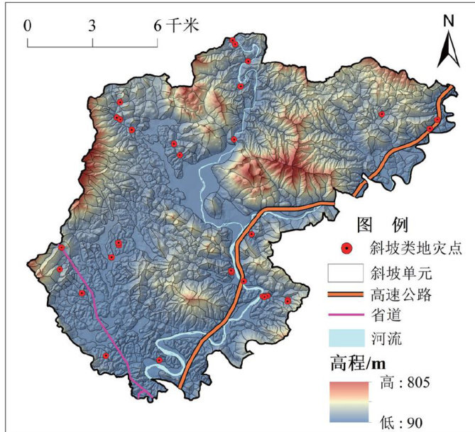
研究区地处粵西北部山地丘陵区,其地质环境条件复杂,地形起伏大,岩土体性质多变,以往的区域地质灾害调查区划工作,已将该地列为地质灾害高易发区。(剩余11940字)
