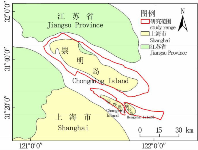
基于遥感的崇明三岛景观格局变化研究及生态安全评估

打开文本图片集
中图分类号:S29 文献标志码:A 文章编号:1671-4652(2025)02-0136-11
ABSTRACT: Based on seven remote sensing data from l999 to 202O,seven indicators such as class area,number of patches,aggregation index were selected.We quantitatively studied the characteristics of landscape pattern changes in the three islands of Chongming(Chongming Island,Changxing Island and Hengsha Island)in 2O years,constructed an ecological securityevaluation system,andanalyzed its driving force factors.Theresults showed that with the increasing influence of human driving force,the waterarea ofChongming threeislands continued todecline from1999 to 2020,while the wetlandarea and theforestarea increasedinstages,andtheagriculturallandandbuildingarea werealways thedominant landscape.Landscape fragmentation continued to rise,heterogeneity increasedfirst and thenstabilized,theconnectivitybecame Worse,the tightness between patchesdecreased,theinternaldominant landscapecontrol declined,and the changes in the ecological security level went through three stages ( .1999-2007 ecological natural restoration stage, 2007—2015 ecological destruction stage, 2015-2020 ecological artificial restoration stage). The ecological security level wasthehighest in2007(atLevelI,a stable state)and thelowestin2Ol5(atLevel II,anunstable state).Theresearch results have guiding significance for the overall ecological protectionofthe threeChongming Islands in the future and the construction of a world-class ecological island.
KEY WORDS: remote sensing; Chongming Three Islands; landscape pattern;ecological security assessment
无论是经济发展还是自然环境,海岛均具有明显不同于内陆地区的特殊性[1。(剩余15398字)
