基于奥维互动地图的电磁环境保护区划设与巡视方法研究

打开文本图片集
关键词:电磁环境保护区;奥维互动地图;可视化;精准定位;划设调整;定期巡视中图分类号:V351.37 文献标志码:A 文章编号:1003-5168(2025)11-0020-04DOI:10.19968/j.cnki.hnkj.1003-5168.2025.11.005
Research on Demarcation and Inspection Methods of Electromagnetic Environment Protection Zone Based on Ovi Interactive Map
LI Xuanxuan ZHANG Qinwei LI Junhui (HenanAirportGroup Co.,Ltd.,Zhengzhou 4511oo,China)
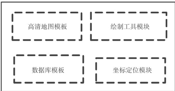
Abstract: [Purposes] In view of the problem of the instrument landing system electromagnetic environmental protection zone,such as imprecise delineation,slow data update,and dificulty in judging the boundary of the protection area during inspection,a demarcation and inspection system for electromagnetic environment protection zone has been developed.[Methods] The system takes Ovi interactive map as the platform,calculates the parameters of the protected area,and uses CAD tools to delineate accurately on the high-definition satelite map.[Findings] The system supported synchronous use of desktop and mobile terminals,realized data visualization,online update and data sharing of the protected area, and achieved accurate positioning.[Conclusions] The application of the system can effectively improve the efficiency of setting adjustment, periodic inspection and emergency handling of electromagnetic environmental protection zone,and reduce the workload of navigation maintenance personnel.
Keywords: electromagnetic environmental protection zone; Ovi interactive map; visualization; accurate positioning; adjustment; periodic inspection
0 引言
仪表着陆系统通过发射航向、下滑信号引导飞机进近着陆,其安全运行对电磁环境保护区有着极高的要求[]。(剩余3549字)
