三维地形风场环境下无人机全覆盖路径规划

打开文本图片集
中图分类号:V279 文献标志码:A DOI:10.12305/j.issn.1001-506X.2025.07.27
Abstract:A wind field terrin adaptive full coverage path planning algorithm is proposed to address the energy non-optimal problem faced by rotor unmanned aerial vehicle(UAV)using back-and-forth full coverage paths inthree-dimensional terrain and wind field environment.Firstly,the environment is modeledusing the grid method,and aerial waypoints are constructed based on the elevation data point information within the grid. Next,by analyzing the maneuvering actions and energy functions of the rotary wing UAV in the wind field environment, a wind model and energy consumption model of the UAV are constructed. Then,based on rolling optimization and global thinking,a fusion strategy of neighbor roling probing and global prediction is proposed as the algorithm core to plan the UAV approximate optimal fullcoverage path that adapts to the wind field and undulating terrain energy.Finally,simulation experiments is conducted in diferent environments. The experimental results indicate the necessity of considering wind field and terrain,and compared to single reciprocating coverage,the proposed algorithm can adapt to environmental factors for planning,significantly reducing energy consumption during the full coverage process.
Keywords:unmanned aerial vehicle (UAV); path planning; full coverage; wind field; three-dimensional terrain
0 引言
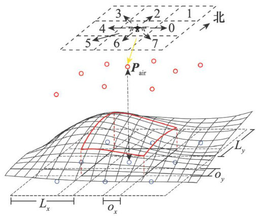
无人机被广泛应用在一些以往需要消耗较多人力物力的场景中,例如区域巡防、摄影测量、智慧农业、灾害监测等等[1-4]。(剩余15421字)
