基于指针网络架构的多星协同成像任务规划方法

打开文本图片集
中图分类号: V19 文献标志码:A DOI:10.12305/j. issn. 1001-506X.2025.07.18
Abstract: With the increase in the number of satelite resources,user imaging demands are also rapidly expanding. There is an urgent need to strengthen research on multi-satelite coordinated imaging task planing to enhance satelite service capabilities.This paper conducts research on multi-satellte coordinated imaging task planning based on deep reinforcement learning. Firstly,a mathematical model for multi-satelite cooperative imaging task planning is established,taking into account task requirements,satelite capabilities,and spatiotemporal constraints. Then,a satelite task planning algorithm based on pointer network is designed. This algorithm employs the pointer network mechanism to optimize the selection of input sequences and utilizes a Mask vector to represent various constraint conditions. Finally,simulation results show that the algorithm achieves an average task benefit improvement of at least 1.71% compared to traditional heuristic algorithms and pointer network model.The average task benefit diference for algorithms trained on instances of different task scales is no more than 0.28% ,demonstrating the effectiveness and applicability of the algorithm.
Keywords : multi-satellte cooperative imaging;task planning;deep reinforcement learning; pointer network
0 引言
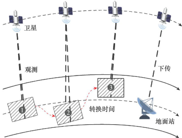
对地观测卫星(以下简称卫星)利用星载成像传感器观测地球表面以获取图像信息,由于其具有观测范围广、不受地理条件、国界限制等独特优势,在军事侦察、农业生产、应急救灾等领域得到了广泛应用[1-2]。(剩余16627字)
