机载三维激光雷达技术在道路测量中的优势及应用实践研究

打开文本图片集
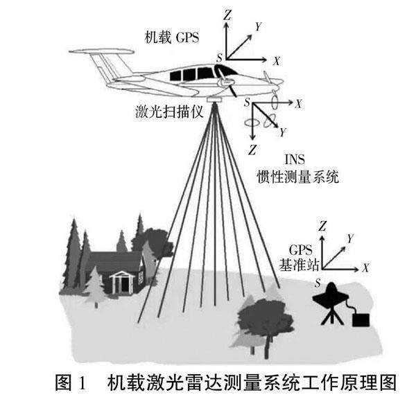
摘 要:机载激光雷达测量技术是一种新型的航空测量技术,具有独特优势,尤其是在道路勘察测量工作中发挥重要作用。该文主要对机载三维激光雷达技术在道路测量中的应用实践进行探究,旨在进一步提高道路测量工作效率和质量,推动道路工程施工设计水平的提升。
关键词:机载三维激光雷达技术;道路测量;优势;应用实践;关键问题
中图分类号:P225 文献标志码:A 文章编号:2095-2945(2023)09-0185-04
Abstract: Airborne LiDAR measurement technology is a new type of aerial survey technology, which has unique advantages, especially plays an important role in road survey. This paper mainly explores the application practice of airborne three-dimensional LiDAR technology in road survey, in order to further improve the efficiency and quality of road survey and promote the level of road engineering construction design.
Keywords: airborne 3D LiDAR technology; road survey; advantages; application practice; key problem
机载三维激光雷达技术在道路测量中的应用,改变了以往公路勘测设计的传统方法,进一步提高了测量效率,保障测量数据精准度,推动整体工作质量的提升。(剩余5914字)
