无人机技术在数字城市建设中的创新应用

打开文本图片集
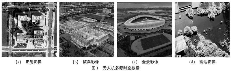
摘 要:无人机技术在城市信息的全面感知和快速获取方面发挥至关重要的作用,该文通过分析无人机实景三维技术、全景影像技术、视频回传技术、目标识别定位技术、避障和运载技术等特点,阐述其在数字城市时空数据库建设和时空一体化平台建设中的创新应用,指出其在推动数字城市的建设和发展中的重要意义。
关键词:无人机技术;数字城市;实景三维;720全景;时空数据库
中图分类号:P231 文献标志码:A 文章编号:2095-2945(2023)09-0173-04
Abstract: UAV technology plays an important role in the comprehensive perception and rapid acquisition of urban information. This paper analyzes the characteristics of UAV real 3D technology, panoramic image technology, video return technology, target recognition and positioning technology, obstacle avoidance and transportation technology, and expounds its innovative application in the construction of digital city spatio-temporal database and spatio-temporal integration platform. It is pointed out that it is of great significance in promoting the construction and development of digital city.
Keywords: UAV technology; digital city; real 3D; 720 panorama; spatiotemporal database
随着大数据时代的到来以及互联网、云计算、物联网、地理信息和人工智能技术等新一代先进信息技术的发展,数字城市的建设已经成为了一种新型的城市建设理念。(剩余5315字)
