GIS辅助下的学生就业分析研究

打开文本图片集
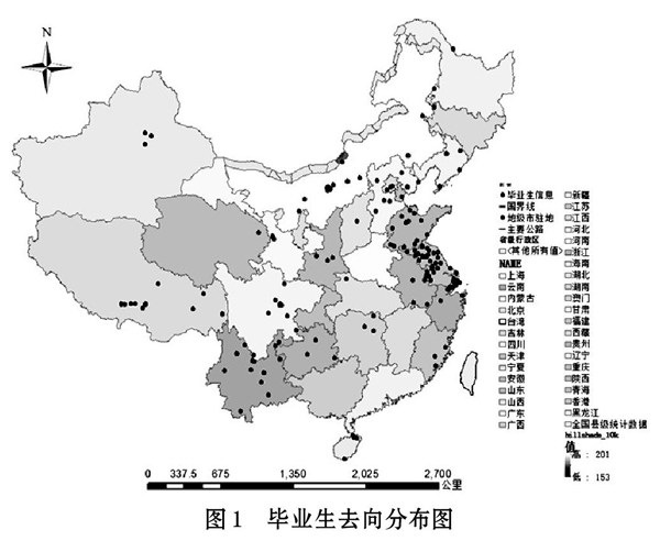
摘 要: 以南京某高校应届毕业生实际就业情况为第一手地理原始数据,进行地理空间化数据处理、筛选、剔除、整理,利用GIS技术进行地理空间信息分析研究,将传统的就业报表建立成为可以实时进行直观表达的地理就业空间分布图,并对高校毕业生的实际就业地理空间信息分布和人才流向情况进行宏观分析。
关键词: 大学生就业; GIS; 空间分析; 就业分布
中图分类号:G646 文献标识码:A 文章编号:1006-8228(2022)05-141-04
GIS-assisted student employment analysis and research
Chen Jiexin, Deng Zhihao
Abstract: Taking the actual employment situation of fresh graduates from a university in Nanjing as the first-hand geographic data, the geospatial data is processed, filtered, rejected, and sorted. By using GIS technology for geospatial information analysis and research, the traditional employment report is established into a geographic employment spatial distribution map that can be visually expressed in real time, and a macro analysis of the actual employment geospatial information distribution and talent flow of college graduates is carried out.
Key words: college students employment; GIS; spatial analysis; employment distribution
引言
就业情况稳定是我国社会民生稳定的基础,在人口众多的中国,就业永远是各级政府需要精心谋划的一件头等大事。(剩余5176字)
