5G全生态智慧国土感知平台建设实践

打开文本图片集
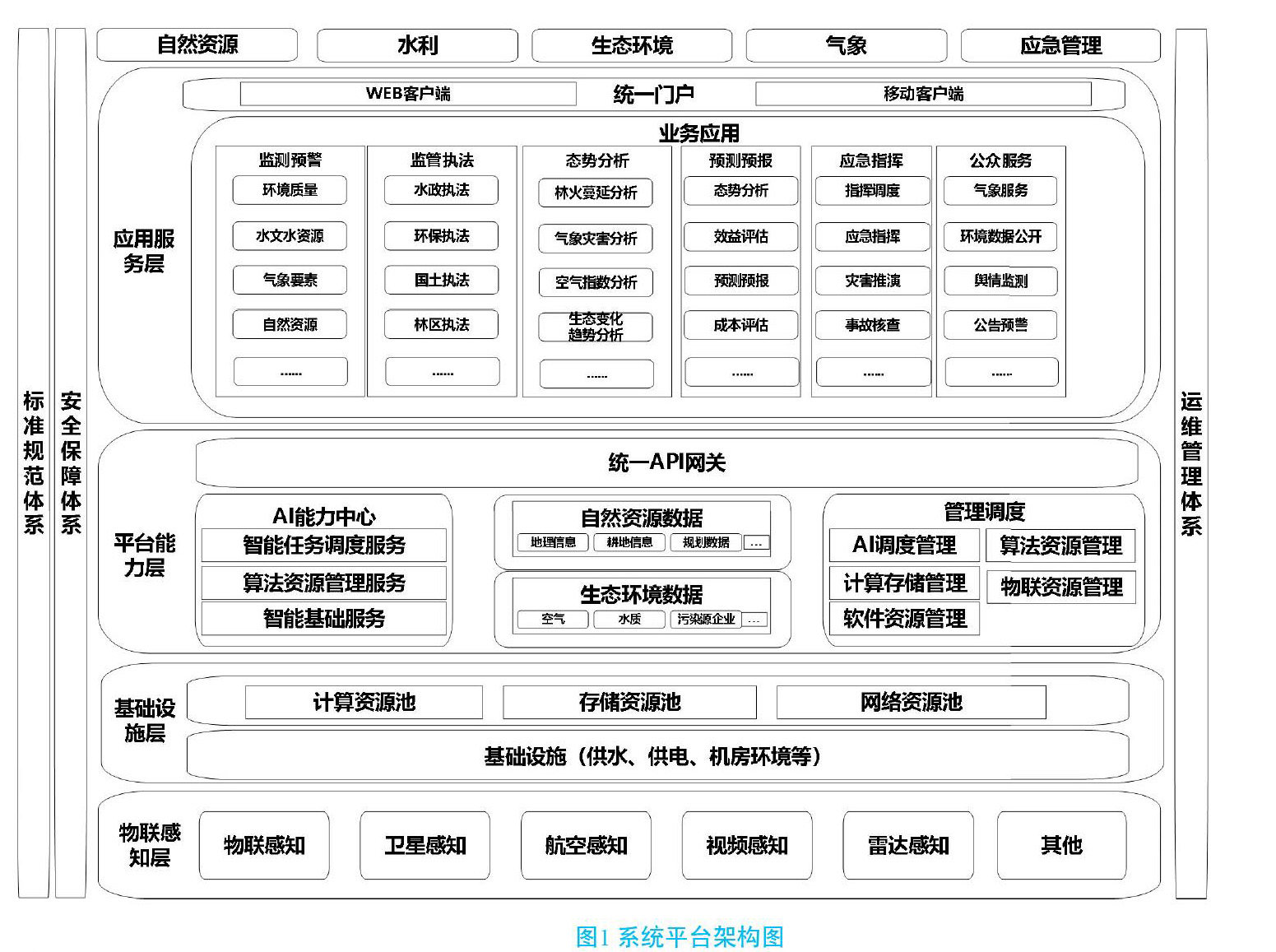
摘要:结合国土资源监管和生态环境保护需要,充分利用5G网络,建设一个以预测预警为核心,以实时视频数据、空间数据为驱动,创新识别算法,智能协同、全景即时感知的“空、天、地”一体化智慧监管系统,构建“天上看、地上查、网上管"的管理机制,有力解决国土资源和生态环保等社会治理中的痛点难点问题。
关键词:5G;智慧;国土;感知平台
doi:10.3969/J.ISSN.1672-7274.2022.10.013
中图分类号:F 424,TN 929.53 文献标示码:A 文章编码:1672-7274(2022)10-00-05
Construction Practice of 5G Full Ecological Smart Land Perception Platform
FANG Liangjun
(China Mobile Communications Group Hainan Co., Ltd., Haikou 570100, China)
Abstract: In combination with the needs of land and resources supervision and ecological environment protection, make full use of 5G network to build a "space, sky and earth" integrated intelligent supervision system with prediction and early warning as the core, real-time video data and spatial data as the driving force, innovative identification algorithm, intelligent coordination and panoramic real-time perception, We will build a management mechanism of "looking from the sky, checking from the ground, and managing on the Internet" to effectively solve the pain points and difficulties in social governance such as land resources and ecological and environmental protection.
Key words: 5G; wisdom; territory; perception platform
近年来,由于土地资源需求上升、资源供给受刚性制约,自然资源管理面临保障发展难、保护资源难的局面。(剩余6863字)