遥感卫星DOM元数据自动填写软件的设计与实现

打开文本图片集
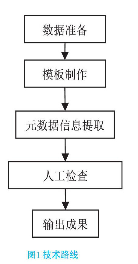
摘要:近年来,随着遥感卫星影像处理技术的发展,生产效率也越来越高,其相应的元数据作为测绘成果,一直沿用人工填写的方法,已经不能满足生产的需求。文章介绍了结合正射影像生产实践实现的批量元数据自动填写的技术路线和实现方法,大大减少了人工填写的工作量,提高了工作效率。
关键词:遥感卫星;元数据;正射影像;自动填写
doi:10.3969/J.ISSN.1672-7274.2022.10.007
中图分类号:P 236 文献标示码:A 文章编码:1672-7274(2022)10-00-03
Design and Implementation of DOM Metadata Auto Filling Software for Remote Sensing Satellite
WANG Binwei, WANG Yiqi
(Unit 61175, Nanjing 210049, China)
Abstract: In recent years, with the development of remote sensing satellite image processing technology, the production efficiency is getting higher and higher. The corresponding metadata, as the surveying and mapping results, has been filled in manually, which can not meet the production needs. This paper introduces the technical route and implementation method of batch metadata automatic filling based on the production practice of Orthophoto, which greatly reduces the workload of manual filling and improves the work efficiency.
Key words: remote sensing satellite; metadata; orthophoto; auto fill
目前,随着国内遥感卫星发射的越来越多,其获取的遥感影像种类也越来越丰富,应用范围越来越广泛,影像处理技术越来越先进,在影像处理工序基本实现了正射影像生产的自动化。(剩余2853字)