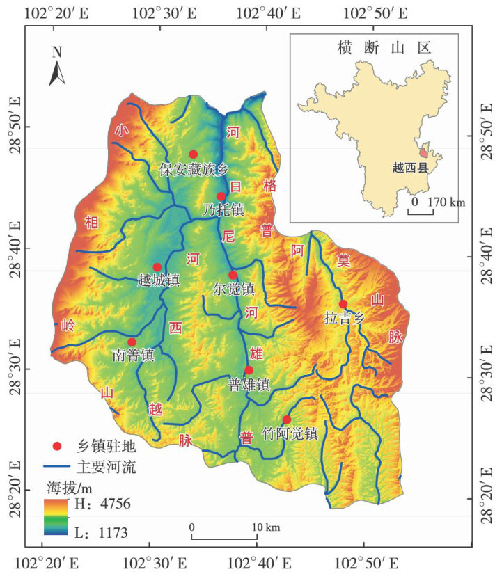
退耕背景下横断山区典型县域土地利用地形梯度分异及驱动因素

打开文本图片集
中图分类号:F323.2 文献标志码:A 文章编号:1673-5072(2025)04-0387-09
Abstract:Studying the terrain gradient differentiationof land uses in the typical county within the Hengduan Mountains under the background of returning farmlandsand their driving factors is essential for fostering regional ecological civilization.Based on the high-precision land use data from 2OoO to 2020,this study analyzed the terrain gradient diferentiation and their driving factors of land uses in Yuexi county with the help of terrain gradient classification and thePLUS model.The results show:(1)From 2000 to
2020,Yuexi county predominantly features grassland and forest land,comprising roughly 77.95% ofthe total area,which shows a noticeable expansion in forest land,construction land,and unused land,buta decline in other land categories.(2)The land use in Yuexi county presents a notable characteristic of terraingradientdifferentiation,withcultivated land,construction landandwaterareaclustering inlow-altitude,flatvalley regions,whereas forest land,grassland,and unused land in expansive,undulating mountainous terrin.(3)The expansion of cultivated land,forest land,grassland,waterarea,construction land, and unused land is predominantly driven by farmland productivity potential,slope,distance from railways, aspect,population density,and elevation,respectively.The evolution of land use types in this county is shapedby the interplayof natural and economic forces.Itis necessary forYuexicounty to implement tailored spatial planning strategies,so as to optimize land use structures and promote harmonious development between human and land.
Keywords:PLUS model;land use;terrain gradient;driving factor; Yuexi county
土地利用指人类对土地自然属性的利用状况[1],是维持人类生存与发展的最基本实践活动[2],土地利用是人类和自然相互作用的最直接表现[3]。(剩余9883字)
