基于斜坡单元的山区场镇地质灾害风险评价
——以四川省雅安市石棉县新民乡为例

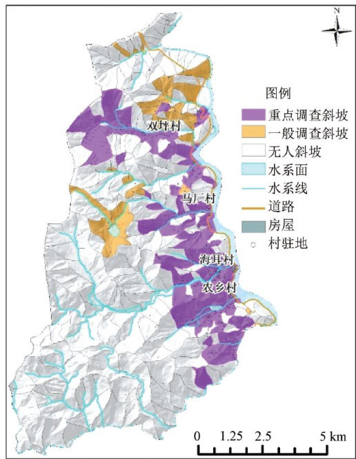
打开文本图片集
中图分类号:P694 文献标识码:A 文章编号:2097-5465(2026)01-0080-09
Abstract:Thisarticleselects Xinmintownship in Shimiancounty,Ya'ancity,Sichuanprovince,thecoreareaofthe"9.5" Ludingearthquake,asatypical'mountainous townforresearch.Firstly,basedonDEMdata,remotesensing images,andfield refinementsurveysintheresearcharea,ArcGISsoftwarewasusedtopredividetheslopeunits.Then,human-computerteaction wasused toimprovetheslopeunits.Finally,adjustmentsandcorrections weremadeaccoringtotefieldsurveyresultstoformthe finalslopeunits.Then,theinfluencefactorswithdiferentweightsandthesemiquantitativeevaluationmethodareusedtoevaluate thevulnerability,danger,vulnerabilityandriskoftheslopeunit.Thehazardandriskleveloftheslopeunitundertheadverse conditiosofeavyainfallwereobaned,ndtheiskpreventioandcontrolzningascarrdout,hichprovidessitificad technicalsupportforcaryingoutthedualcontrolof"hiddentroublepointsandriskareas"inthestudyarea.Itpromotesthe transformationof geologicaldisasterpreventionandcontrolfrompasiveemergencyresponsetoactivepreventionandcontrolin complex geological environments and ishighly operable.
Keywords:slope unit;mountainous towns;geological hazards;risk assessment
0 引言
近年来,全国多地开展了重点场镇1:10000 地质灾害精细化调查和风险详查工作,许多学者也对此开展了大量的研究工作,大比例尺风险评价还需要高精度的调查数据与合适的评价方法做支撑,这也是地质灾害调查评价研究过程的一个难点。(剩余7528字)
