基础地理信息产品质量控制系统设计

打开文本图片集
摘 要:该文设计一款基于“微服务+平台”架构的基础地理信息产品质量控制系统,该系统具有可扩展性强、支持数据种类多、检查功能完备、系统运行速度快及检查流程图形化简单可控的特点,有效地提高基础地理信息数据的质量检查速度与精度。
关键词:数据质量检查;系统设计;微服务+平台;地理信息数据;速度与精度
中图分类号:P208 文献标志码:A 文章编号:2095-2945(2023)17-0102-06
Abstract: A basic geographic information product quality control system based on "Micro Service plus Platform" architecture is designed. This system has the characteristics of strong expansibility, many kinds of supporting data, complete inspection function, fast running speed of the system and simple and controllable graphical inspection flow, which effectively improves the quality inspection speed and accuracy of basic geographic information data.
Keywords: data quality check; system design; Micro Service plus Platform; geographic information data; speed and accuracy
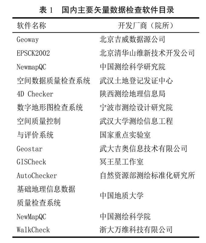
基础地理信息数据产品主要可分为4大类:数字划线地图(Digital Line Graphic,DLG)、数字高程模型(Digital Elevation Model,DEM)、数字栅格地图(Digital Raster Graphic,DRG)及数字正射影像图(Digital Orthophoto Map,DOM)[1]。(剩余5160字)
