无人机摄影测量技术在地籍测绘中的应用方法及管理对策

打开文本图片集
摘 要:随着无人机在测绘领域的广泛应用,无人机摄影测量技术也在地籍测绘作业中得到长足发展,发挥重要作用。该文结合实际,运用文献法等对无人机摄影测量技术在地籍测绘中的应用方法及管理对策展开分析探究,提出有关观点,以供借鉴参考。
关键词:无人机摄影测量;地籍测绘;技术应用;应用管理;数据模型
中图分类号:P271 文献标志码:A 文章编号:2095-2945(2023)26-0176-04
Abstract: With the wide application of UAV in the field of surveying and mapping, UAV photogrammetry technology has made great progress and played an important role in cadastral surveying and mapping. Based on practice, this paper uses the method of literature to analyze and explore the application methods and management countermeasures of UAV photogrammetry in cadastral surveying and mapping, and puts forward relevant viewpoints for reference.
Keywords: UAV photogrammetry; cadastral mapping; technical application; application management; data model
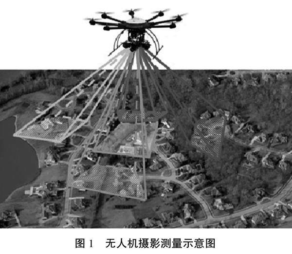
地籍测绘是地籍管理中的一项重要工作,通过地籍测绘,了解土地利用现状,掌握土地及附着物权数、位置、质量和数量等基本情况,从而做出更为科学合理的土地规划与管理决策。(剩余5148字)
