基于EVSpro的某工业园区三维地质模拟及地下水污染物空间分布模拟

打开文本图片集
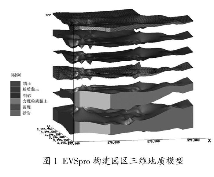
摘 要:目前,国内外缺乏对位于较复杂地质条件区域的三维地质模拟,且模拟结果也缺少验证。该文将以某工业园区为例,利用收集到的大量地质勘察资料,建立山前洪积平原与河流冲积平原交汇地带三维地质模型,验证其准确性,并开展地下水中总氮污染物的空间分布模拟。
关键词:EVSpro;三维地质建模;模型验证;污染物分布模拟;地质勘察
中图分类号:TP391.9 文献标志码:A 文章编号:2095-2945(2022)24-0086-04
Abstract: At present, there is a lack of three-dimensional (3D) geological simulation located in areas with complex geological conditions at home and abroad, and the simulation results are also lack of verification. Taking an industrial park as an example, this paper uses a large number of geological survey data collected to establish a three-dimensional geological model of the confluence zone of piedmont alluvial plain and river alluvial plain to verify its accuracy, and carries out the spatial distribution simulation of total nitrogen pollutants in groundwater.
Keywords: EVSpro; 3D geological modeling; model verification; pollutant distribution simulation; geological survey
随着社会经济的发展,我国在山前洪积、河流冲洪积形成的平原上建立了诸多工业园区,这些园区的设立有利于实现资源共享和产业共生、提高资源能源利用效率[1],但是随着生产时间增长,园区范围内的土壤及地下水环境受到污染的风险也不断增大[2],因此对园区地质、水文地质条件、污染状况的调查评估迫在眉睫。(剩余4099字)
