基于海拔梯度的华北落叶松林地上碳储量模型

打开文本图片集
中图分类号:S718.56 文献标志码:A 文章编号:1673-923X(2025)09-0159-11
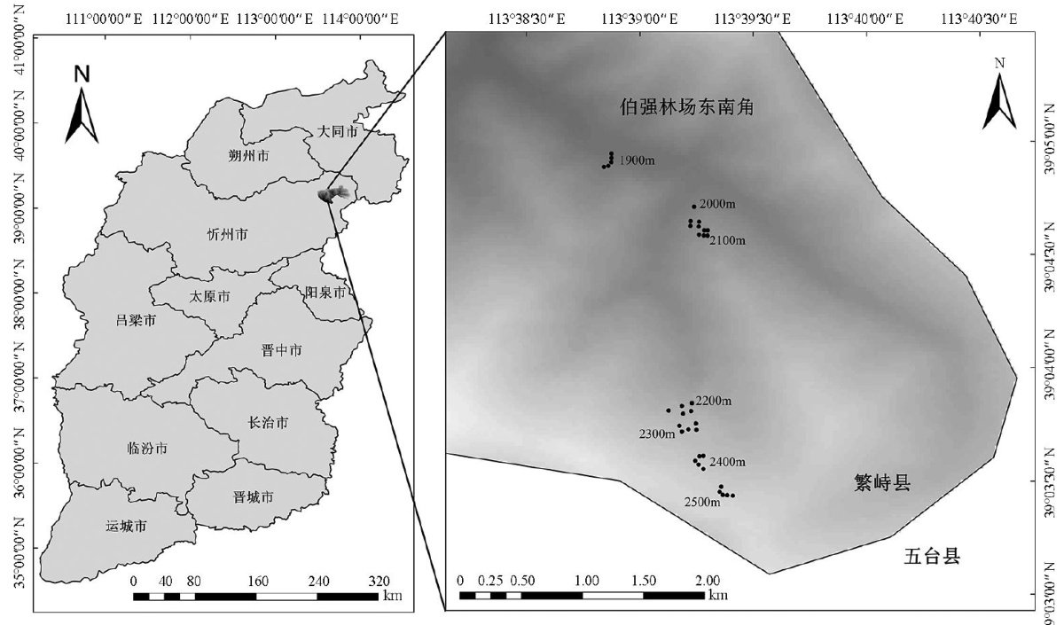
Abstract:Objective】Elevatioalgradintisacriticalenvironmentalfactorafectingforestcabostoragedistrbutioninmountaious ecosystems,yetthenonlinearmechanismsandoptimalelevationZonesremainunclear.Thisstudyaimstorevealthedistribution paternsofforestcabostoragealonglevatioalgadientsiLrixpncipis-rupchtiiforestsmparetepredictivepfce ofdifferentmodelingapproaches,andtoexplorethapplicationpotentialofLiDARtechnologyinforestcarbostorageasessnt. 【Method】Basedonfieldsurveydatafrom35plotsandLiDARdata,thisstudyappliedlinearregression,polynomialgsion mixed-efectsmodels,andgeneralizedaditivemodels(GAM)tomodelandcomparetherelationshipbtweencarbonstorageand elevation.Leave-one-outcros-validation wasused toevaluate modelpredictiveperformance,andstandardevaluationmetrics such as the coefficient of determination (R2) ,standard error of estimation (SEE),and mean percentage error (MPE)were calculated. 【Result】ForestcbonstorageofLrixprincipis-rupprechtiiehitedasgnificantinvertedU-sapeddistrbutionpatealogthe elevational gradients( 1900-2500m ),withanoptimal elevation zone of 2 000-2 200m and a theoretical optimal elevation of 2165m Elevation was the dominant factor explaining carbon storage variation,accounting for 89.5% ofthevariance (η2=0.895 P<0.001 ) Among the four modeling approaches,GAM performed best (fitted R2=0.907 ,cross-validation R2=0.888 ,prediction standard error= (2号 10.15t/hm2 with only 1.86% overfiting.LiDAR-derivedcanopydensity (Intensitycv) emerged asan important predictor,significantly improvingmodelpredictionaccuracy.【Conclusion】This studyconfirmedthenonlineareffectsof elevational gradienton forest carbonstorage,withGAMdemonstratingclearadvantagesinmodelingcomplexecologicalrelationships.LiDARtechnologyhows greatpotentialinforestcabonstorageassessment,providingthicalsupprtforstablsingmoutainfoestcarbonsnkoitoring systems.Theresearchfndings willprovidescientificbasis foradaptive forestmanagement under climate changeand precision forest management based on elevational gradients.
Keywords:forestcarbonstorage;elevationalgradient;generalizedaditivemodel;LiDAR;Larixprincipis-rupprechti
森林是全球碳循环的重要组成部分,面积达40.6亿 hm2 ,约占陆域的 1/3[1] 。(剩余21031字)
