GPS 技术在测绘工程中的应用分析

打开文本图片集
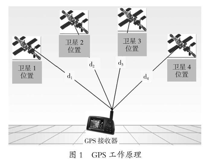
摘要:近年来,全球定位系统(GPS)在我国诸多领域得到应用,尤其是测绘工程领域。GPS技术可以提高测绘速度,操作便捷,经济性好。本文结合大方县1∶500地形图测绘实例,分析GPS技术的应用特点,明确数字地形图测绘要点,深入探讨无人机航拍技术的具体应用,以供业内人士参考。
关键词:GPS技术;测绘工程;应用;数字地形图测绘;无人机航拍
中图分类号:P228.4 文献标识码:A 文章编号:1008-9500(2023)11-00-03
DOI:10.3969/j.issn.1008-9500.2023.11.014
Application Analysis of GPS Technology in Surveying and Mapping Engineering
ZHANG Ying
(112 Geological Brigade, Guizhou Bureau of Geology and Mineral Exploration and Development, Anshun 561000, China)
Abstract: In recent years, global positioning system (GPS) has been applied in many fields in China, especially in the field of surveying and mapping engineering. GPS technology can improve surveying speed, facilitate operation, and have good economy. Based on the example of 1∶500 topographic mapping in Dafang County, this paper analyzes the application characteristics of GPS technology, clarifies the key points of digital topographic mapping, and delves into the specific application of UAV aerial photography technology for reference by industry insiders.
Keywords: GPS technology; surveying and mapping engineering; application; digital topographic mapping; UAV aerial photography
大方县位于贵州省西北部,隶属于毕节市,县城距省会贵阳市150 km,全县面积约为3 500 km2。(剩余2518字)
