哈达山水利枢纽工程左岸防护区浸没治理研究

打开文本图片集
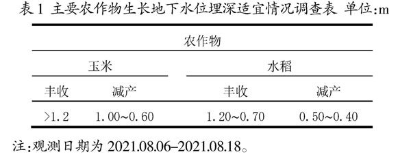
摘 要:文章首先介绍哈达山水利枢纽工程左岸防护区的地理位置、现状和治理范围,通过对防护区内土层结构、农作物种植结构的综合分析,确定防护区内地下水浸没临界深度1.5 m。根据治理区的地形地质条件,确定浸没治理的工程措施。
关键词:防护区;浸没;治理
中图分类号:TV52 文献标志码:A 文章编号:2095-2945(2022)21-0051-04
Abstract: This paper firstly introduces the geographical location, status quo and treatment scope of the protection area on the left bank of the Hadashan Water Control Project. Through a comprehensive analysis of the soil structure and crop planting structure in the protection area, the critical depth of groundwater immersion in the protection area is determined to be 1.5 m. According to the topographic and geological conditions of the treatment area, the engineering measures for immersion treatment are determined.
Keywords: protected area; immersion; treatment
1 工程概况
1.1 地理位置
哈达山水利枢纽工程(一期)位于第二松花江干流的下游,大坝坝址位于吉林省松原市东南向20 km左右处,下距离第二松花江与嫩江汇合口60 km左右处,是第二松花江流域最末一级控制性枢纽工程,工程由坝区枢纽工程、防护区防护工程和输水工程组成。(剩余5008字)
