2025年秋季海洋天气评述

打开文本图片集
中图分类号:P732.2 文献标志码:A 文章编号:2096-3599(2026)01-0139-10
DOI:10.19513/j.cnki.hyqxxb.20260119001
Autumn 2025 marine weather review
ZHANG Chengbao, ZHANG Zenghai, LIU Tao,WAN Weiqi,GUO Yiying,WANG Qian (National Meteorological Center,Beijing 100o81,China)
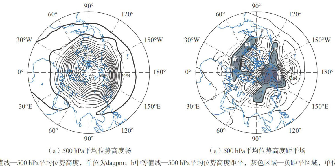
AbstractThe atmospheric circulation during the autumn (from September to November) of 2025 was characterized by a single-pole type of polar vortex in the Northern Hemisphere and a 4-wave pattern in the middle and high latitudes.In Eurasia,the circulation pattern was flat,exhibiting a“two troughs and one ridge” pattern,and there were no significant ridges or troughs in the westerlies.A total of 13 typhoons formed in western North Pacific and the South China Sea,1.66 more than the multi-year (from 1949 to 2024)average.In addition,22 tropical cyclones were named in the world’s other oceans.A total of 14 gale events of Beaufort wind force scale 8 or above occurred over China’s offshore waters, including three events induced by typhoons,6 by the combined influence of typhoons and cold air,one by extratropical cyclones,three by the joint efects of cold air and cyclones,and one solelyby cold air.There were 18 sea wave events with significant wave height exceeding 2.0m ,with large wave days accounting for about (204号 74.7% of the total number of days during autumn. In autumn,the sea surface temperature (SST)in China's offshore waters was generally higher than the climatological normal. In September,the maximum positive SST anomaly occurred in the eastern Yellow Sea and the northeastern East China Sea, 3-4qc above the climatological normal,whereas in October,the minimum SST anomaly occurred over the Bohai
Seaand the Bohai Strait,less than 1∘C above the climatological normal.Keywordsatmospheric circulation; typhoon; gale; wave height; sea surface temperature(SST)
0 引言
本文结合2025年秋季(9—11月,下同)北半球的大气环流特征及逐月演变情况,分析中国近海天气变化,总结中国近海发生的主要灾害性天气及其影响。(剩余9852字)
