基于GEE多特征优选的设施农业类型信息提取

打开文本图片集
中图分类号:P237;S127 文献标志码:A 文章编号:2096-3599(2025)03-0117-12
DOI:10.19513/j.cnki.hyqxxb.20241019001
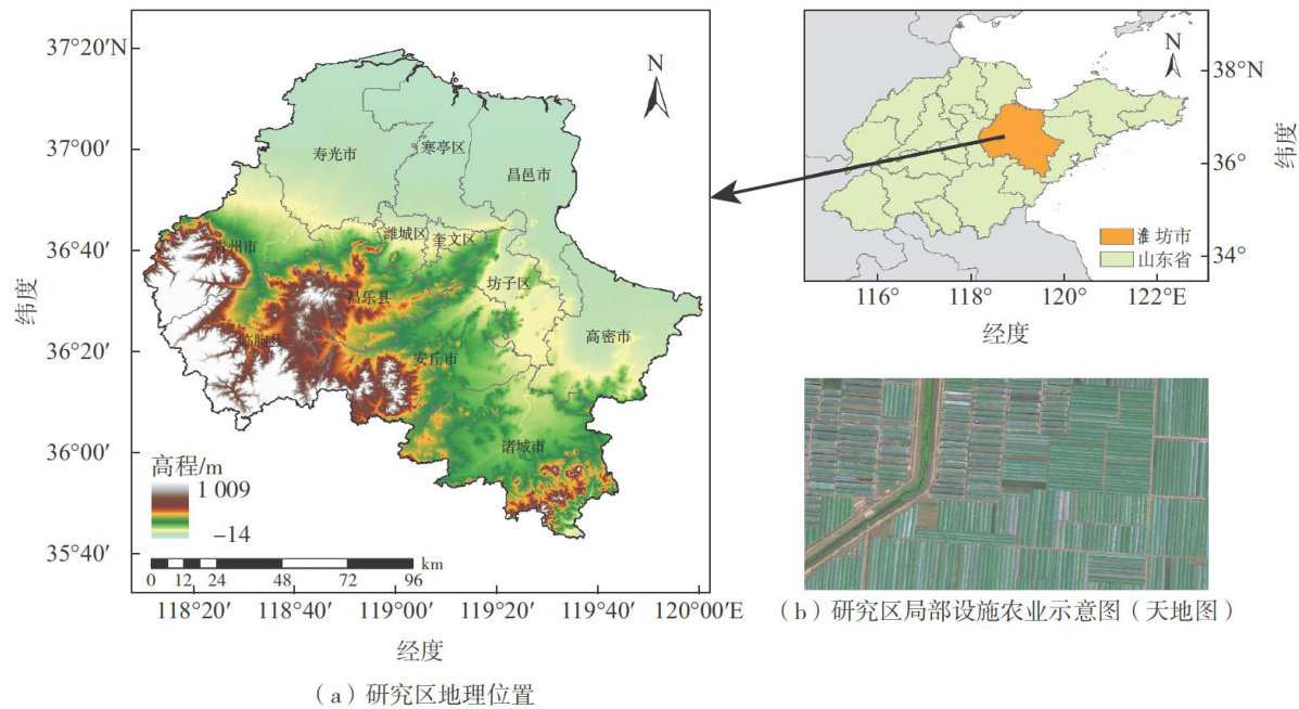
AbstractTo distinguish and precisely extract the information of different types of facility agriculture, this study takes the solar greenhouses and polyhouses in Weifang as the research objects using the Google Earth Engine(GEE)platform.By integrating Sentinel-1 radar data,Sentinel-2optical dataand SRTM DEM data,41 feature variables are extracted,including the features of spectrum,index,radar,texture and topography,and the optimal selection of features is conducted. By comparing 14 window scales with the cumulative diffrence method,the optimal texture features for Sentinel-2 imagery are identified.The experiments with 6 combinations of features are designed using the random forest classification algorithm to generate a distribution map of facilityagriculture in Weifang with the resolution of 1O m in 2023,and the impacts of different combinations on the accuracy of extraction are explored.The results are outlined below.(1) The optimal window scale of the texture feature for extracting facility agriculture using Sentinel-2 is 27×27,and the best combination of texture features includes Mean,Entropy,Variance, Dissimilarity and Contrast.(2) Besides the features of spectrum and index,the features of texture,radar and topography are used to classify facility agriculture.The order of diferent features beneficial to extract facility agriculture from high to low is texture,topographyand radar,and compared to the classification using only spectrum and index,the accuracy increases by 4.08% , 1.40% and 0.80% ,respectively. (3)The optimal selection of features yields the highest clasification accuracy, with an overall accuracy of 91.03% and a Kappa coeficient of O.86. The producer’s accuracy and user’s accuracy for polyhouses are 92.21% and 91.83% ,respectively,while those for solar greenhouses are 88.54% and 89.47% , respectively.(4) The remote sensing extraction method for various facility agriculture types in Weifang using Sentinel imagery and SRTM DEM topography data offrs decision-making support for disaster risk management of facility agriculture.
Keywordsfacility agriculture;Sentinel satellite;GEE(Google Earth Engine);random forest
0 引言
设施农业是现代农业的重要组成部分,作为一种显著延长作物生长季节和提高作物产量的新型生产方式,能够有效提高资源利用率并增强农业系统的防灾减灾能力,是保障“菜篮子工程”顺利开展的重要技术措施[1]。(剩余14062字)
