“天-空-地”协同的滑坡监测
——以川西小金县甘沟村为例

打开文本图片集
[分类号]P694 [文献标志码]A
Abstract: The critical challnge in modern landslide disaster prevention and management is theearlydetectionof potential landslide events,precise monitoringof their development,and proactive implementationof mitigation measures.This study employs an integrated“space-air-ground”cooperative monitoring system,utilizing multitemporal optical satelite imagery,unmanned aerial vehicle (UAV) photogrammetry,small baseline subset interferometric synthetic aperture radar (SBAS-InSAR), global navigation satelite system (GNSS),and ground-based InSAR(GB-InSAR) for comprehensive,multisource,and multi-temporal monitoring of the Gangou landslide.The SBAS-InSAR results indicate that there was an anomalous deformation area in the Gangou landslide, with a maximum annual average deformationrate of -123.34mma .TheGNSS and GB-InSAR monitoring data further indicate that the deformationrate atthe leadingedgeof the secondarylandslide exceeded thatat the trailing edge.Itis found that the deformation rates in the GB-InSAR monitoring area range from -14 to 10mm/d :The results of the cooperative monitoring show that the landslide in Gangou Vilage could be divided into three levels of deformation areas: a strong deformation area of 0.25km2 ,an area where deformation was significantly affected by rainfall, and a low-stability area.Field investigations corroborate our findings from the space-air-ground cooperative monitoring approach.The Gangou landslide predominantly exhibited a failure mechanism,where frontalcolapse induced adownward displacement at the rear edge.The deformation and failure mechanism is identified as creep sliding and fracturing. This study provides critical insights for the effective monitoring and management of analogous landslides.
Key words: Gangou landslide; space-air-ground cooperative monitoring; SBAS-InSAR;GNSS; GB-InSAR
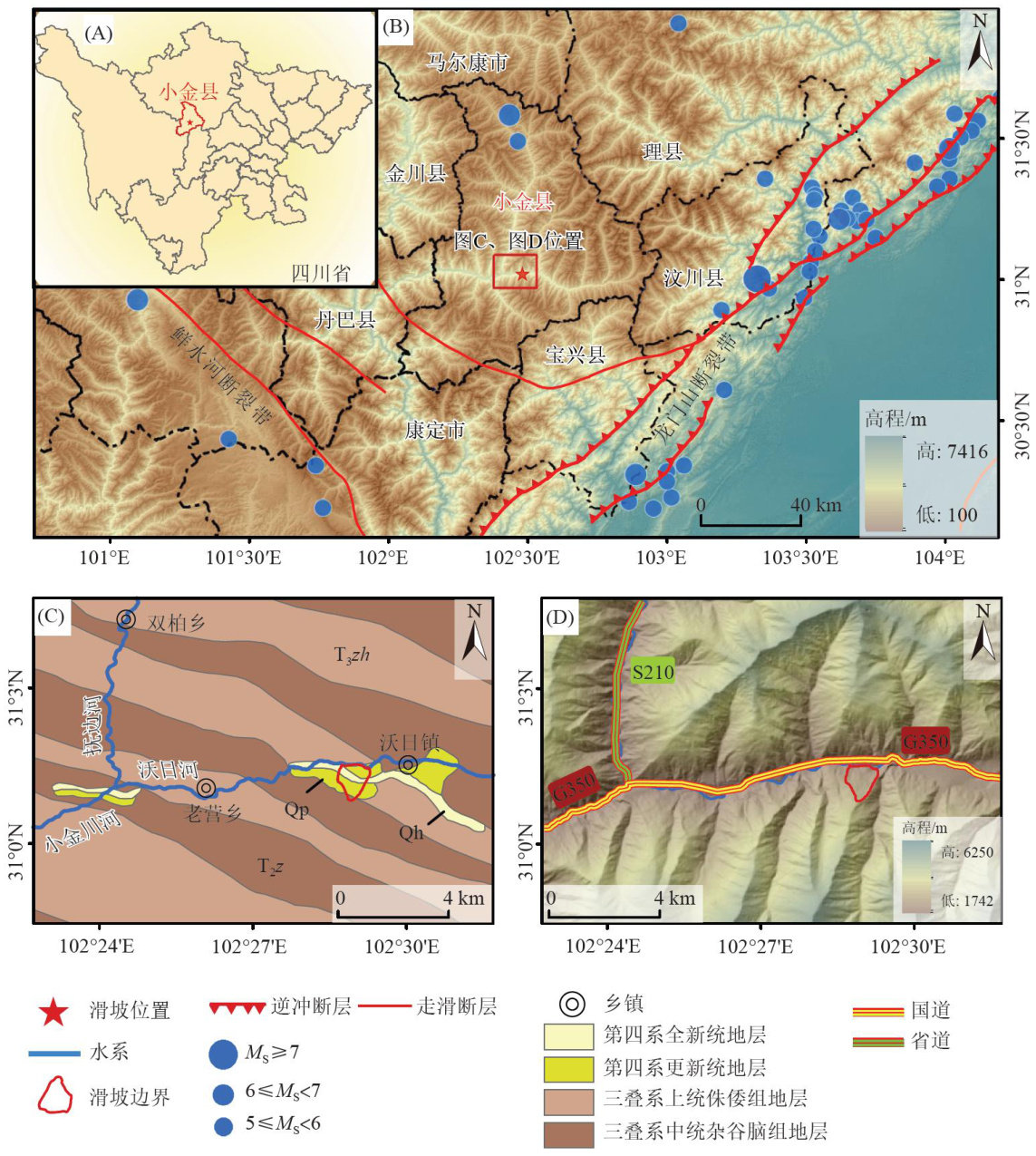
利用多源对地观测技术对斜坡地表形变进行探测和监测是滑坡隐患早期识别与监测预警最有效的技术手段(许强,2020;邓季政等,2023)。(剩余20851字)
