青岛东南部海域地形地貌特征研究

打开文本图片集
中图分类号:P737.2
文献标志码:A
文章编号:1005-9857(2026)04-0080-09
Research on the Topographic and Geomorphic Characteristics of the Southeastern Sea Area of Qingdao
LI Dawei 1 , XIAO Jingjing 2 , GUAN Wenhui 1 , ZHU Tao 2 , ZHU Wanlu 1 , WANG Daokuan 1 , BI Xiangli 2 , JIANG Yue 3,4
[1. China Three Gorges Renewables (Yantai Muping District) Co., Ltd., Yantai 264100, China; 2. Shanghai Survey, Design and Research Institute Co., Ltd., Shanghai 200335, China; 3. North China Sea Survey Center, MNR, Qingdao 266100, China; 4. Shandong Provincial Key Laboratory of Marine Ecological Environment and Disaster Prevention and Mitigation, Qingdao 266000, China]
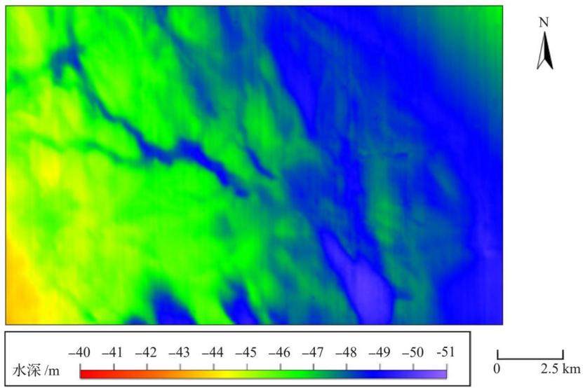
Abstract: The study area is located in the sea east of Qingdao in the southern part of the Shandong Peninsula, belonging to the South Yellow Sea region. This study conducted a comprehensive investigation of it through beam full coverage sounding and side-scan sonar, processed the obtained data, and combined with the relevant historical materials of the study area, carried out a detailed analysis of the water depth topography and seabed geomorphic features of the study area. It found that the water depth in the study area ranges from -41.3 m to -50.7 m, and generally showed a trend of gradually deepening from northwest to southeast. The study area was divided into four levels of geomorphic units based on relevant historical data. The fourth-level geomorphic units were further detailedly classified, mainly including gentle slopes, ancient river valleys, depressions, and ancient river channels and so on.
Keywords: Shandong Peninsula; South Yellow Sea; Seabed topography; Multi-beam depth sounding; Side-scan sonar; Seabed geomorphology
0 引言
山东半岛南部海域地处南黄海西北部,是连接陆架浅海与海岸带的关键地带。(剩余13468字)
